
You are currently browsing the category archive for the ‘New York’ category.
We limply arrived in Pawling, NY yesterday in early evening. We experienced 4 days out of 5 days with wet weather. Cane fell down many times due to the wet condition on the trail. At nights, it was cold to sleep. *sigh* Our beloved mobile Trail Angel, Paul E. came up via train and got off at AT train station in Pawling, NY to visit us today and tomorrow. It is really good to see and chat with him! We plan to resume our hiking this Monday toward Salisbury, CT for next 5 days or so. There may be another wet weather. UGH. Wish us the best luck to stay in one piece and get through. Sorry to keep this message short since the library closes in 5 minutes. Until next time, folks!
PS Bear Jew and Rockpuncher – The steps at the Bear Mountain and RPH shelter rock!
We are staying at the shelter owned by the monastery tonight. Bill Irwin, the blind hiker, mentioned about this place in his book, so why not we get to check out this place. In addition, we get to be a monk for a bit while. =)

We get to be a monk for a day and a night. 😎
Hello folks! As we were creeping up our way to the Bear Mountain in Hudson Valley of the state of New York, we are going to hike from Bear Mountain by crossing Bear Mountain bridge over Hudson River toward Pawling, New York. My right knee is still hurting, but becoming less hurting and swollen as the time goes by. We were limited to short day hiking(between 1 to 7 miles a day) last week. I went to see my doctor last Friday and had MRI done to make sure there is no any tearing in my right knee. My doctor suspected that there may be no tearing involved, however I will get the result from MRI this week. We enjoyed ourselves at Trailside Museums and Zoo near to Bear Mountain bridge. I hope I am able to hike with less difficulty this week especially with full gear backpacking and going downhill (it hurts the most). This week, it will be around 42 miles of hiking in a stretch. Hope for a good weather and injury-free this week.
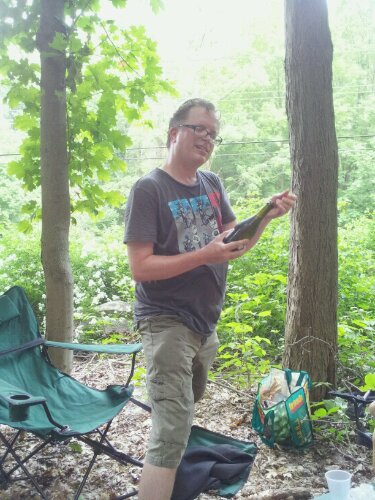
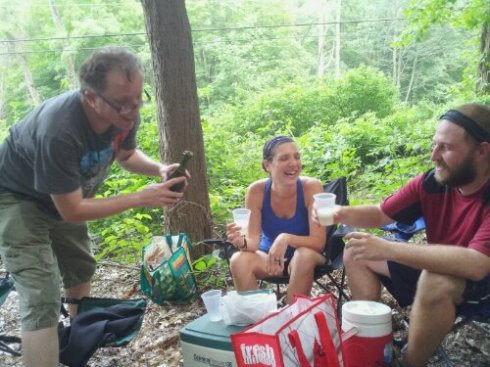
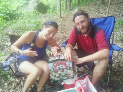
Yesterday, we said our good-bye to our mobile Trail Angel, Paul E. who spent a month (April 2012) supporting us. We thank him and my family for their support and time to make sure that we continue with our journey. After crossing the Hudson River, we will be pretty much on our own. We hope to arrive Williamstown, MA in mid-May to end of May. *crossing fingers*
Have a good week, folks.
Hello folks! Today’s hiking went good, but my knees hurt most when I hiked downhill. Going to take it one day at a time. We hope to arrive Bear Mountain by this weekend. Cane is doing ok so far. He plans to comment on his posting other day when the time permits.
We didn’t expect maniacal hiking portion in the Greenwood Lake region in New York. We did expect the lunatic portion between Fitzgerald Falls and Agony Grind (how appropriate name for that particular portion, believe us!!!) based on Track-R’s testimony. Yesterday morning, we were half-way of the lunatic portion. The weather was wet – rained all day the day before and drizzled throughout the day yesterday. After saying good-bye to our mobile Trail Angel Paul E., we hiked to Little Dam Lake region. We came upon the swollen creek which we couldn’t believe in our own eyes when we spied the white marker on other side of the creek. Sheesh! I gingerly managed to get across the creek over some rocks with getting a bit of wet in my boots with aid of two wooden sticks from the forest. It was difficult for Cane to get across without getting wet, so I asked him to toss me his backpack. He agreed, so he took it off. I told him where to toss and he tossed behind me which was off target from where I expected. I caught it all right, but it forced me to dive into the crevice of the rocks twisting my right knee (I tweaked it back in High Point region in New Jersey) and banged my left knee. Lucky, the crevice of the rock was part of the creek which kind of soften my diving, but soaking me right to my bones and up to my face! I scrambled to get myself out of the creek dragging the backpack with me. I tossed it over on the other side of the creek. I quickly climbed to the solid ground and was in pain for a while. I forced myself to move to see if I was able to walk and it took awhile to shake off the pain. I was able to walk, thanks goodness, but in some pain. Cane was worried and scared for me. He got himself to other side of the creek by wading through the creek up to top part of his thighs. We had to squeeze the water out of our socks and insoles and poured some water out of our boots. We decided to hike rest of 4 miles being wet rats. It might be a good idea to add “n” to end of Dam from what we experienced. 😉 Today, we took zero day since my right knee swollen up and left knee complaining of some aches. I count my blessing that I didn’t break any bones or tear any ligament! We will go hiking tomorrow to see how my knees feel.
Hello, folks! Cane asked me to summarize about what happened for past few days. After getting lost for 3 hours on Monday 16-April in low 90’s degrees F weather, we hiked to Wawayanda shelter – the last shelter in the state of New Jersey – to spend a night there. We got to meet up and chat with a sectional hiker named Track-R – the one we met on the AT back in July 2010 in Virginia. Track-R is the brother of sectional hiker named Downhill Donna – the one we hope to meet up this year. 😎 We enjoyed our chat. Track-R called Cane – “Amazing Cane” which lit up on Cane’s face.
Next day, we were about to leave the Garden State and enter into the Empire State and was told by Track-R that there were some challenging trails in the state of the New York. When we entered into Greenwood Lake region, we encountered four obstacles that required us to do some hand climbing to get around or over the massive rocks – some of them were few feet drop (around 10 to 30 feet!). It was a bit hair raising situation. Not only that, the trail maintenance was so bad enough that we had to hike through swampy, buggy, and overgrown area with fading white markers from time to time. At one area, Cane came down by stepping down the rocks and the trail was curved to left. He was a bit off-balanced and went off-trail due to his balance challenge and the heavy weight of his backpack. The fallen tree with its branch sticking out was on his right side. He struck its branch right on center of his chest at mid-level which left him some bruises and broken skin. Lucky, the end of the branch was blunt, so it was not sharp enough to stab him. It left him in shock for a bit while not expecting to be “poked” hard that way as he was accustomed to being beaten up, scratched, tripped over or poked by the fallen logs or live trees. After climbing and hiking for 9.5 hours on the 10 miles stretch (ideally, it was supposed to be 5 hours for 10 miles of hiking), we decided to call our lifeline just right before the sunset – RamSham’s parents to pluck us from the forest to go home to rest and get some treatment for Cane instead of going to the next shelter which was two more miles away.
We are slackpacking for a few days with support of our mobile Trail Angel Paul E. and RamSham’s family – it helps that Cane doesn’t have to carry heavy backpack which easily throw him off on top of his balance challenge. We plan to continue slackpacking for a few more days before we will be on our own hiking toward Williamstown, Massachusetts.
We resume our hiking today from Pochuck Mountain in New Jersey toward Bear Mountain in New York this week. The boots saga continues: Cane is now on his 9 th pair of his boots as he bought a new pair last week. He ought to be a good quality test candidate for boots company. O:-) Anyhow, have a good week, folks.
Hello folks. My car has been out of commission, so I was car-less pedestrian for a long while. Thanks to my dear friend’s help, my car is all fixed up and in good shape again. I just got it back a few days ago. Cane’s health is ok now. He just needs to watch how he eats to avoid recurring heartburn. He needs to cut down on fatty food and desserts. Anyhow, since our break from the Appalachian Trail expedition in New Hampshire, there is a new development – Aftermath of Hurricane Irene. Irene came ashore on last weekend of August which left many areas in the Northeast (between New Jersey and Maine) flooded and/or destroyed. Many trees fell along the trail. Even there was a 3-inch hole in one of shelters. The famous boardwalk over the swamp in New Jersey is closed due to flooding. Here is the link to trail updates complied by ATC.
Cane and I discussed today and made a decision to hold off our AT expedition to between March or April. That way, we can start off from Delaware Water Gap in New Jersey and walk north toward North Adams, Massachusetts. That way, we can start to build up our endurance and stamina and get ready to conquer the White Mountains in New Hampshire and Katahdin in Maine. It also gives the trail maintainers some time to work on restoring and cleaning up the trails.
Mmmmmmmmmm!
Cane’s Uncle Jean and Aunt Rose were able to join us to celebrate our milestone of midpoint/halfway at Blue Benn Diner, 1940’s diner based on diner from Paterson, New Jersey (yay! Can you detect pride of Jersey Girl?!) It was soooo nice to see them again! We left to hike in wet shower on Saturday 16-October.
We arrived in Williamstown, Massachusetts on Sunday 17-October. We were thrilled to complete our hiking in the state of Vermont. We enjoyed its hospitality, new and old friends, foods, and environment.
Upon our arrival in Massachusetts, Cane came down with a cold and some coughing. We stayed at Williamstown Motel for a couple of nights before deciding to hop on the bus going to New York City today. We will decide whether if we want to continue hiking for a few more days or hang up our boots for hiatus until next Spring. We plan to keep you posted.

